
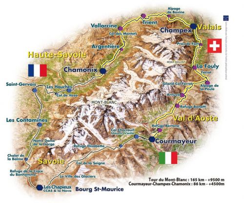
We hiked the Tour du Mont Blanc, 110 miles, through France, Italy and Switzerland to circumnavigate the Mont Blanc Massif in 12 days in July, 2018.
Day 1:
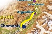
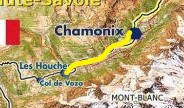
July 11: from Gite Michel Fagot to Miage
 Climbing up and over the Col de Voza, across snow fields, up and over the Col de Tricot, and then steeply down to Miage. 8 hours, roughly 10 miles, over 1100 m elevation gain followed by a 600 m decent. We met Becker, an avid long distance hiker from Israel, and super nice guy.
Click images to see larger version


Day 2:
July 12: from Miage to Gite le Pontet, Les Contamines

A short hike down to Contamines. We made fun little summit of Mont Truc and had a great lunch in Contamines.


Day 3:
July 13: from Gite le Pontet, les Contamines to Auberge de la Nova, Chapieux

An over 9 hour day crossing snowfields to crest two passes: Col du Bonhomme and Col de la Croix du Bonhomme. Roughly 1500 m of ascent followed by almost 1000 m of descent.


Day 4:
July 14: from Auberge de la Nova, Chapieux to Elisabetta
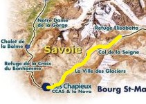 A 7 hour 1000 m climb to Col de la Seigne, the border between France and Italy. A rainstorm came up just as we reached the pass. It was incredibly windy, cold and rainy with poor visibility. Ruby was freezing and we struggled to get her into her rain gear. Meanwhile, Jane’s pack cover flew off her pack and over her face. We were disoriented trying to find the right path down off the Col. Luckily runners in an ultra-marathon came by just then and helped us find the right direction. They also gave us some perspective on our panic as they calmly ran by unflustered by the storm. We took no pictures at the pass. We met Sean, Sarah, and Katie, triplets from upstate New York at Elisabetta.


Day 5:
July 15: from Elisabetta to Maison Vielle
 Ruby’s birthday and France wins the World Cup final.


Day 6:
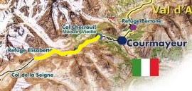
July 16: from Maison Vielle to Bertone stopping in Courmayeur
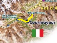 We hiked down to Courmayeur and spent a couple hours in the town running errands and eating lunch. Then we made the steep climb to Bertone. We meet a French family hiking the TMB with children as young as eight at Bertone.


Day 7:
July 17: from Bertone to Alpage de la Peule
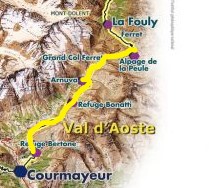 Our longest day, 10 and a half hours, over the highest pass Grand Col Ferret took us from Italy to Switzerland.


Day 8:
July 18: from Alpage de la Peule to Gite Bon Abri, Champex
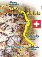
A 9 hour day often at lower elevation through villages.


Day 9:
July 19: from Gite Bon Abri, Champex to Auberge du Mont Blanc, Trient
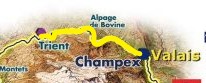 A seven hour hike over Alp Bovine. In Trient we spent more time with Sean, Katie and Sarah and met Lindel and Yvette.


Day 10:
July 20: from Auberge du Mont Blanc, Trient to La Boerne, Tre le Champ
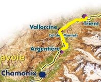
A crowded trail up and over Col de Balme.


Day 11:
July 21: from La Boerne, Tre le Champ to Le Flegere
A drizzly day’s hike with ladders over the steepest sections.


Day 12:
July 22: from Le Flegere to Les Houches
Our last day with a climb to Brevant followed by a long descent into Les Houches


Aiguille du Midi
The day after concluding our hike, we took the cable car to the summit of Mont Blanc


